
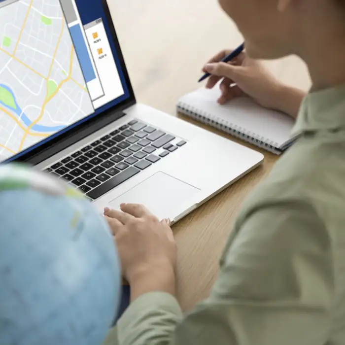
Locator & Sensor Integrations
Specialists in high-precision locator and sensor integrations
Our expert team can help optimise asset tracking, environmental monitoring, and geospatial mapping.
Inaccurate data, inefficient data tracking, and data security concerns could reduce productivity whilst increasing the risk of data breaches.
I-Finity’s locator and sensor integration service can provide your business with precise, real-time insights to enhance efficiency, strengthen security, and save you time and money.


Why use I-Finity for locator and sensor integrations?
Proven expertise: Our extensive experience involves integrating sensor and locator systems for asset tracking, smart home automation, landfill compliance, and land surveying, ensuring we can handle even the most complex projects.
Advanced technical capabilities: Our expertise ranges from cloud applications and system integrations to database design to connecting hardware devices with software solutions.
Cross skilled team: Our technical abilities allow us to deliver high precision accuracy needed to support surveying and use of geospatial software for data collection, mapping and post-processing.
Versatility: We can seamlessly integrate systems with industry-leading technologies like GPS/GNSS receivers (Trimble Catalyst, Emlid), ground conductivity metres (Geonics), laser rangefinders (TruPulse), gamma radiation survey instruments (Ludlum), and utility locators (Vivax), enabling precise environmental sensor data collection for a range of purposes.
GIS knowledge: Our GIS expertise allows us to integrate geospatial data with high-precision GPS/GNSS locators for maximum accuracy and operational efficiency. We have expertise in integrating sensor technology used to capture high-precision location data. Our integration expertise extends to capturing data from cable detection, radio detection and buried utility location capturing devices. This data is then used in integrations with mapping platforms and/or custom software solutions.
Case Study: TerraFlow Geomatics
TerraFlow needed to create a high-precision solution to:
- Enable high-precision surface measurements
- Facilitate seamless data integration with existing systems
- Ensure reliable data capture in remote locations
I-Finity built TerraFlow's suite of custom products that provide automated data collection, streamlined workflows, and improved data-driven decision-making, significantly boosting and optimising operational efficiency for it's users.
The Benefits of Sensor and Locator Integrations

Combining sensors and locators creates a detailed, accurate and real-time understanding of an area or environment.

Our solutions connect, visualise, and export data, empowering businesses with actionable insights for informed business decisions.

Integrated systems provide live tracking and condition monitoring across multiple locations for better control and efficiency.
We have integrated with:


"Working with the I‑Finity team over a number of projects has been a wonderful experience and really they are like an extension of our own team and family. The time difference between Toronto and the UK works nicely as work plans can be built, builds delivered and tested and the results communicated back through to mid-day EST. The next morning, there are fresh items to review. I cannot speak highly enough of the relationship that we've built and the projects completed over the years and the absolute pleasure it has been working with them."
Our Services

Versatile sensor integrations
We can work with motion, weather, pressure, temperature, radiation, and electromagnetic sensors to seamlessly connect them to GPS/GNSS-positioning systems.

Digital Transformations
We can process, visualise, and export data to support and inform decisions, enhancing business growth through better decision-making and streamlined operational effectiveness.

Cloud connectivity and scalability
Our cloud-based infrastructure ensures high availability, data security and seamless integration across platforms for omnichannel connectivity.

Custom software development
We can enhance your existing systems or build new applications, improving user engagement with bespoke features and user-friendly interfaces.

Specialist geo-spatial expertise
We solve complex geospatial data problems and integration challenges, including field data collection.
Our Process for Integrations
1: Scoping requirements: We capture your technical needs, use of locators and/or sensors, explore data collection, display and post-processing requirements.
2: Solution architecture and design: We create bespoke architecture design to support the technical aspects of your sensor and locator integration delivery, seeking access to physical devices where possible to validate technical decisions.
3: Development and testing: Our incremental development and testing approach ensures a high-quality, tested integration to meet your project requirements.
4: Deployment of solution: We implement the solution and monitor performance, accuracy, and data reliability.
5: Ongoing support and maintenance: We provide continuous updates and improvements to keep the integration optimal.

Related Articles
Article
This article explores the benefits of geospatial solutions, the challenges faced by professionals in the field, and the practical uses of custom GIS for the utilities sector.

Article
Exploring the power of GIS mapping software to help monitor, analyse, and predict environmental changes, enabling organisations to map data for improved environmental planning.
Sensor integration gathers data from multiple sensors for real-time analysis, whereas sensor fusion goes further by combining and processing this data to deliver deeper insights and more accurate environmental understanding.


